| ||
|
| A catalogue of all the languages and dialects spoken in Somalia, with details of the numbers of speakers of each language. Also some demographic data such as rates of literacy, blindness and deafness. | |
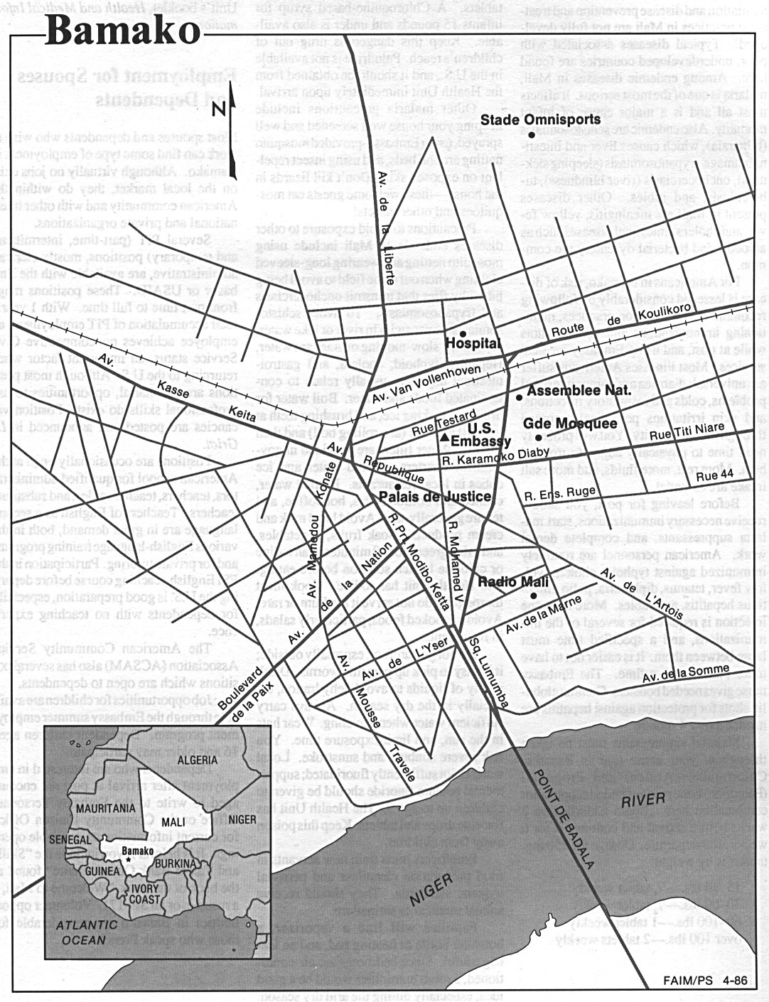
| Map of Bamako, the capital of Mali. | ||
| Detailed assessment of human rights practices in Mali. Topics assessed include torture, arbitrary detention or exile, fair public trial, freedom of speech and press, freedom of assembly, movement and religion; democratic rights, worker rights, and discrimination based on race, sex, religion, disability, language, or social status. | ||
| Detailed assessment of human rights practices in Somalia. Topics assessed include torture, arbitrary detention or exile, fair public trial, freedom of speech and press, freedom of assembly, movement and religion; democratic rights, worker rights, and discrimination based on race, sex, religion, disability, language, or social status. | ||
| Map of Mali showing the main settlements, boundaries and routes. | ||
| Links to a range of Internet resources about Mali. | ||
| A catalogue of all the languages and dialects spoken in Mali, with details of the numbers of speakers of each language. Also some demographic data such as rates of literacy, blindness and deafness. | ||
| Basic reference information about Somalia, such as area, capital, population, population density, geography, language, religion, time zone, history and government, plus business and social information, including details of accommodation, addresses, climate, regions, travel, visas, passports, money, health and public holidays. | ||
| Basic reference information about Somalia, including details of geography, people, economy, government, communications, transportation, military and transnational issues. Geographical information includes area, population, flag, maps, high and low points, co ordinates, boundary length, border countries, climate, land use and natural resources. | ||
| Basic reference information about Mali, including details of geography, people, economy, government, communications, transportation, military and transnational issues. Geographical information includes area, population, flag, maps, high and low points, co ordinates, boundary length, border countries, climate, land use and natural resources. | ||
| Summary of the nature and structure of government of Somalia, with links to several other resources about the country. | ||
| Detailed handbook describing the history of Somalia and analysing its political, economic, social, and national security systems and institutions, the interrelationships of those systems and the ways they are shaped by cultural factors. Particular attention is given to the people who make up the society, their origins, dominant beliefs and values, common interests and the issues on which they are divided, and their attitudes toward each other and toward their social system and political order. | ||
| Listing of political resources relevant to Somalia, with links to parties, organisations, government, media and results of recent elections, where available. | ||
| Listing of political resources relevant to Mali, with links to parties, organisations, government, media and results of recent elections, where available. | ||
| Map of Somalia showing the main settlements, boundaries and routes. | ||
| Set of political and relief maps produced by the CIA covering all the countries in Africa. | ||
| Range of information about the Arab world, including business, news, events, organisations, travel and entertainment, plus a commercial directory and a set of country specific information about various Arab countries. | ||
| Basic reference information about Mali, such as area, capital, population, population density, geography, language, religion, time zone, history and government, plus business and social information, including details of accommodation, addresses, climate, regions, travel, visas, passports, money, health and public holidays. | ||
| Links to a range of Internet resources about Somalia. | ||
| Brief details of the history and geography of Somalia, as well as business, culture, government and transport information. | ||
| ||